Thriving Activity Hubs
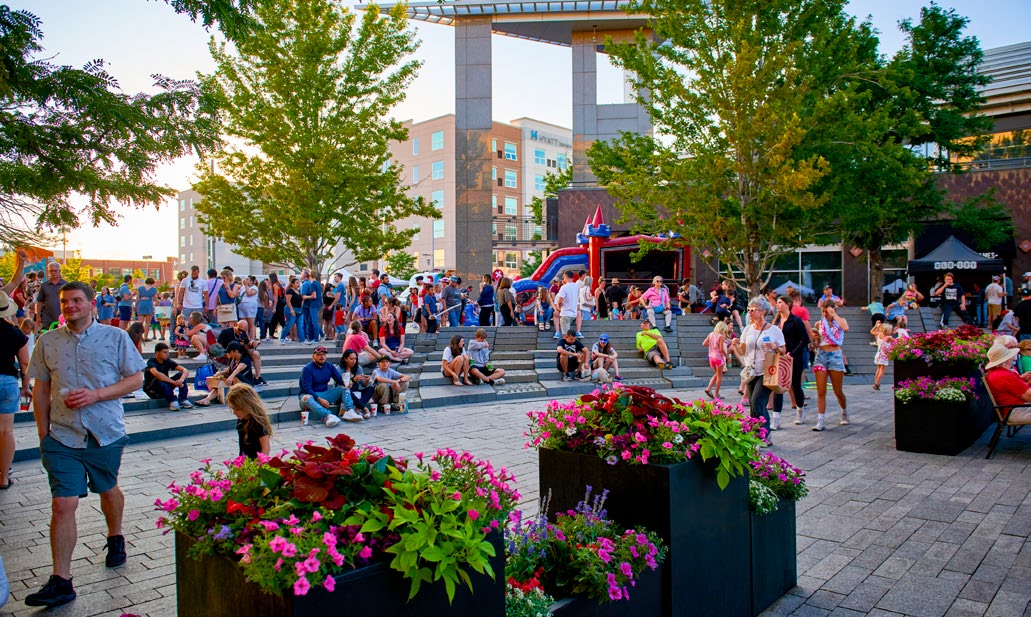
Activity Hubs are the places in Lakewood where residents, visitors, and workers convene most frequently to access services, retail shopping, entertainment, restaurants, and other leisure amenities and attractions. They’re the places people want to be. As key business centers, Activity Hubs also provide important local jobs for the Lakewood community and surrounding region. These hubs are the center of community gathering and activity, with high access demand as people come and go on a daily basis and provide a range of higher density housing options.
As illustrated in the Envision Lakewood Future Land Use Map, the community has identified nine “Community Hubs”, including Downtown Lakewood/Belmar, Denver West/Colorado Mills Shopping Center, and north Union Boulevard and over thirty “Neighborhood Hubs.” Together, these represent Lakewood’s current and anticipated future Activity Hubs, which are characterized by a variety of integrated land uses (including both commercial and residential), a pedestrian-oriented and walkable environment, inviting and inspiring public spaces, and a visible and accessible location—usually at major intersections. Community Hubs serve the broader community at a regional scale and are well-known destinations, while Neighborhood Hubs primarily serve the surrounding local residents.
The community envisions that these areas will evolve into a well-known network of distinct and diversified mixed-use hubs that serve as the primary locations for gathering and commerce. With anticipated growth in the region, there is a need to increase the availability of jobs, services, retail, and leisure opportunities as well as housing. Concentrating this growth in thoughtfully designed mixed-use activity hubs that offer high-quality, accessible, and convenient living environments will allow the community to evolve in a proactive and welcoming way, while minimizing potential impacts on established residential neighborhoods and the natural environment.
Goal 13 Strategies: Thriving Activity Hubs
To realize this goal of curating a network of Activity Hubs, primary strategies focus on efforts for economic development and diversification, promoting infill development, conducting neighborhood and area planning, strategic use of regulatory tools such as zoning and design standards, and investment in high-quality streetscapes and beautification. Supporting strategies focus on the integration of land use and transportation planning to promote multimodal access to and within Activity Hubs and continued planning and investment in iconic Lakewood hubs including 40 West Arts and Downtown Lakewood/Belmar.
Primary Strategies
-
Continue to encourage a mix of land uses to attract diverse, innovative and sustainable industries.
-
Encourage and support activity hubs throughout the city with mixes of land uses that can help protect health and the natural environment and make the surrounding environment more attractive, well connected, economically stronger, socially diverse, and resilient to climate change. These nodes can be the hub for gathering and social events and blend into the surrounding context(s) of the area.
-
Identify under-utilized and under-performing commercial areas and assist in their revitalization, including decarbonization, through the use of state and federal programs such as enterprise zones, the Lakewood Reinvestment Authority (LRA), and other programs and financial incentives.
-
Implement a collaborative approach to develop context- sensitive area plans for targeted corridors, neighborhoods and activity hubs, prioritizing areas with high redevelopment pressure, displacement concerns, environmental hazards, infrastructure needs or other factors to create equitable planning processes. The outcome of these plans can help identify area assets and opportunities for change that are reflective of community input and cohesion.
-
Use the City’s implementation tools such as the Zoning Ordinance, Design Standards, Major Site Plan Review and other applicable regulations to promote development that is respectful of adjacent properties and the surrounding area by considering height, scale, design, connectivity and impacts to the environment. Update these tools as needed.
-
Support the development of areas with a mix of uses within activity hubs and along corridors to integrate and connect residential, commercial, and recreational spaces, fostering vibrant, walkable communities.
Supporting Strategies
-
Enhance the urban tree canopy by planting trees along trails, sidewalks, parks, and waterways in priority heat risk areas and targeted areas identified through regular canopy assessments; developing an urban forestry plan; and engaging the public through educational materials, discounted tree sales, and tree planting events.
-
Continue to implement the 40 West ArtLine Framework Plan and any future updates to the Plan.
-
Integrate natural spaces, tree-lined streets and green infrastructure into site and corridor planning and recreational spaces to improve air quality, support biodiversity, create connected pedestrian greenways and enhance the safety and aesthetics of the corridor
-
Develop and implement a citywide multi-modal transportation plan that includes updates to the existing roadway classifications and establishment of modal hierarchies to create a coordinated and cohesive vision for Lakewood’s future transportation system.
-
Continue to ensure that the safety and access needs for all modes of transportation users are considered with future transportation improvements, including but not limited to pedestrians, cyclists, and equestrians.
-
Support greater density in areas well-served by transit and greater transit service and a greater variety of transportation options in denser areas, while ensuring a dense pedestrian-network where residents have safe and convenient access to destinations and the transportation network, while also considering area context.
-
Re-examine the Zoning Ordinance and other regulations and policies to better integrate multimodal street classifications with land use, environmental considerations, and built form context. Align street typologies with land use and zoning, addressing elements such as setbacks, build-to-zones, sidewalks, landscaping, right-of-way (ROW) and roadway improvements, access requirements, auto-oriented land uses, and others.
-
Modify the parking requirements in the Zoning Ordinance to be consistent with the context of the area, applicable state laws, and best practices to calibrate a balance between sufficient parking, vibrant places, and reducing harmful environmental impacts such as heat islands.
-
Develop a micromobility strategy that addresses the safety, access, comfort, and convenience of vulnerable road users, and parking or storage for these methods, including people walking and rolling by all modes, including wheelchairs, skateboards, scooters, strollers, bikes, one-wheels and more.